
Skip to content
Volcán Tunupa Bolivia — estratovolcán dormido de 5.321m en la orilla norte del Salar de Uyuni con reflejos en el agua del altiplano
condor
— Dormant stratovolcano · 5,321m · North shore Salar de Uyuni · Tahua

Tunupa Volcano,
Bolivia.

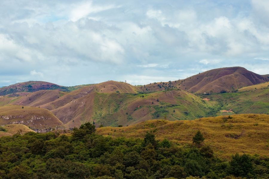
According to Aymara legend, the tears of the goddess Tunupa mixed with her breast milk created the Salar de Uyuni. The dormant 5,321m volcano dominates the northern shore of the salt flat, with pre-Hispanic mummies in its caves and the most complete views of the world's largest salt flat from its summit.

Summit altitude
5,321m above sea level
Type
Dormant stratovolcano
Shore
North Salar de Uyuni
Base village
Tahua · Aymara community
Ascent
4–5h from Tahua
From Uyuni
120km · 2h by 4×4
— How long do you need

The summit is optional. The shore is not.

1 day
  • Leave Uyuni in 4×4 (5:00am)
  • Drive along the northern shore (2h)
  • Visit Tahua village and northern shore
  • Partial hike on Tunupa lower slopes (2–3h)
  • Return via Salar interior

The no-summit option. The northern shore drive to Tahua already gives spectacular views of the volcano and the salar in full extension. Tunupa's lower slopes have pre-Hispanic petroglyphs. Ideal for those who don't want to commit a full day to the summit ascent.

2 days
  • Day 1: Leave Uyuni (5am) → Tahua (2h by 4×4) → begin ascent
  • Day 1: Tunupa ascent: 4–5h up + 3h down
  • Day 1: Night in Tahua (village accommodation)
  • Day 2: Full Salar de Uyuni 4×4 crossing
  • Day 2: Incahuasi → south zone → Colchani → Uyuni

The recommended itinerary. The Tunupa summit requires good fitness and prior acclimatisation. Staying overnight in Tahua allows an early start for the ascent and the afternoon for descent. The second day crosses the Salar east to west — the most complete version of the Uyuni circuit.

3 days — Uyuni-Atacama Circuit
  • Day 1: Train Cemetery + Salar de Uyuni (south)
  • Day 2: Tunupa and northern shore + Tahua (overnight)
  • Day 3: Coloured lagoons + Andean fauna → San Pedro de Atacama (Chile)

The grand circuit. Three days covering the complete Bolivian southwest and crossing into Chile. Only with a specialist agency and expert 4×4 driver. The Atacama route crosses national reserves with coloured lagoons (Laguna Colorada, Verde, Blanca) above 4,500m.

— What to see at Tunupa Volcano

The goddess, the mummies and the salt flat.

A dormant volcano at 5,321m with an Aymara legend, pre-Hispanic mummies, petroglyphs, flamingos, and the best panoramic view of the full Salar de Uyuni from its summit.

🌊
Tahua village · oral tradition

The Aymara Legend of Tunupa

Tunupa — the goddess whose tears created the world's largest salt flat

The Aymara legend of the Salar de Uyuni's origin centres on Tunupa, a goddess of the altiplano. The story: Tunupa fell in love with Kusku, but he abandoned her for another woman, Kusina. Heartbroken and breastfeeding her child, Tunupa's tears and breast milk flowed down the mountain and mixed on the altiplano to form the Salar de Uyuni. The volcano's permanent snow cap represents Tunupa's eternal sorrow. This cosmological account makes Tunupa one of the most sacred natural sites in Aymara culture.

Local tip
The legend is still actively transmitted in Tahua village. Ask in the village for a local guide who can tell the full story of Tunupa — the oral account includes details of the other characters (Kusku, Kusina) and the cosmological relationship between the volcano, the salt flat and the flamingos. The CEDEC cultural centre in Tahua sometimes organises storytelling events.
🏔️
Tahua → summit · 4–5h ascent

Summit Ascent · 5,321m

Pre-Hispanic mummies · 360° panoramic Salar views · non-technical

The Tunupa summit (5,321m) is a demanding high-altitude trek from the base village of Tahua (3,650m). The ascent takes 4–5 hours and the descent 2.5–3 hours. The trail is non-technical (no ropes or ice equipment required in most conditions) but the altitude gain of 1,671m from Tahua demands excellent acclimatisation. Near the summit, pre-Hispanic mummies have been found in cave sites — these are among the best-preserved high-altitude mummies in Bolivia. The summit view encompasses the full Salar de Uyuni (10,582 km²) spread below.

Local tip
Do not attempt the summit if you have been in Bolivia for less than 3 days or have any altitude sickness symptoms. Hire a local guide from Tahua (Bs 150–200) — they know the exact trail conditions, current snow cover, and the location of the mummy caves (which are not marked). Start by 6am from Tahua. Bring warm layers — summit temperature can be –10 to –15°C even in summer — plus sun protection and at least 2L of water.
⚱️
Summit caves · 5,000m+

Pre-Hispanic Mummies in Summit Caves

Chullpa burial sites · Aymara and Inca period · remarkable preservation

Cave sites near the Tunupa summit contain pre-Hispanic mummies from the Aymara and Inca periods (approx. 900–1600 CE). The extreme altitude (5,000m+), dry conditions and cold temperatures of the volcano create a natural environment for exceptional mummy preservation. The mummies were found in chullpa burial sites (stone funeral towers) and cave niches on the crater rim. Some specimens show evidence of elaborate burial textiles and offerings. The site has been documented by Bolivian archaeologists but not formally excavated.

Local tip
Access to the mummy caves requires a local guide from Tahua — the sites are on private community land and the guide ensures respectful access and proper orientation. Do not remove or disturb any objects at the site. Photography should be done with discretion and the guide's approval. The caves are approximately 30–45 minutes below the summit, making them accessible without reaching the full summit.
🦩
Northern Salar shore · seasonal

Flamingo Lagoons · Northern Shore

Three species of Andean flamingo · November–March peak breeding season

The northern shore of the Salar de Uyuni, near Tunupa, hosts some of the most accessible flamingo colonies in Bolivia. Three species of Andean flamingo breed and feed on the salt lakes along this shore: the Andean flamingo (Phoenicoparrus andinus), James's flamingo (Phoenicoparrus jamesi) and the Chilean flamingo (Phoenicopterus chilensis). The lagoons are saltwater and shallow — ideal for the algae and invertebrates the flamingos filter from the water. November–March is the peak breeding season; populations can reach several thousand individuals.

Local tip
The flamingo lagoons are passed en route from Uyuni to Tahua — most drivers stop 20–30 minutes. Ask your driver to stop specifically at the lagoon near the Tunupa base. For the densest flamingo concentrations, morning hours (before 9am) are best — the birds are most active feeding at dawn. Bring a telephoto lens (200mm minimum) or binoculars — the flamingos tend to stay in the centre of the lagoons.
🪨
Tunupa lower slopes · 3,800–4,200m

Petroglyphs · Lower Slopes

Pre-Inca rock art · geometric patterns and camelids · Tiwanaku period

The lower slopes of Tunupa have pre-Inca rock art (petroglyphs) carved into volcanic rock surfaces. The petroglyphs depict geometric patterns, human figures, camelids (llamas and alpacas) and hunting scenes dating to the Tiwanaku period (400–1100 CE) and later Aymara occupation. The petroglyphs were carved into the dark volcanic basalt of the lower slopes. This is one of the least-visited petroglyph sites in Bolivia due to the remoteness of the northern Salar shore.

Local tip
The petroglyphs are on the lower slopes of Tunupa (below 4,200m) and accessible without a summit attempt. Ask your guide from Tahua specifically to include the petroglyph sites — they are not on the standard ascent trail and require 20–30 minutes of detour. The sites are on community land and accessible with local guide accompaniment. Best visited in the morning when the low sun angle creates shadow relief making the carved lines more visible.
🏘️
Base of Tunupa · 3,650m

Tahua Village · Aymara Community

1,200 inhabitants · traditional weaving · authentic altiplano hospitality

Tahua is the Aymara community of approximately 1,200 inhabitants that sits at the base of Tunupa on the northern shore of the Salar. It is one of the most traditional villages in the Uyuni region — more remote and less touristically developed than Colchani on the south shore. Tahua has basic guesthouses run by local families, a small market, and community weaving cooperatives producing traditional altiplano textiles. The village has the authentic character of an Aymara altiplano community with minimal tourist infrastructure.

Local tip
Stay at least one night in Tahua to experience the community in full. The Alojamiento Tahua (community-run) is basic but clean. Mornings in Tahua are extraordinary: the Tunupa volcano at dawn, the salt flat extending to the south, and the local community preparing for the day. Ask your host family if you can watch (or participate in) weaving — traditional patterns specific to the Tunupa region use iconography from the Tunupa legend itself.
— History, geology and context of Tunupa

The volcano that created the salt flat.

Six perspectives on Tunupa: geology, Aymara cosmology, high-altitude archaeology, fauna and the altiplano context.

🌋
Geology of Tunupa
Tunupa is a dormant stratovolcano of the western Andean volcanic arc, with a summit at 5,321m above sea level. It formed in the late Pleistocene (approx. 2 million years ago). The last documented volcanic activity was several thousand years ago. The volcanic cone is exceptionally symmetrical and visible from over 100km on the flat altiplano. The crater interior has sulphur deposits and minor fumaroles in a resting state.
🧂
The connection to Salar de Uyuni
The Aymara legend is poetically correct in its geological essence: the Salar de Uyuni is the residue of ancient altiplano lakes (Lake Ballivián, Lake Minchin) that evaporated 10,000–40,000 years ago. Tunupa drains its runoff directly into the Salar. Tunupa's volcanic minerals contribute to the mineral chemistry of the Salar, which contains 70% of the world's known lithium reserves in addition to sodium chloride.
🏺
High-altitude archaeology
The Tunupa archaeological sites belong to the Tiwanaku cultures (400–1100 CE) and the late Aymara lordships (1100–1450 CE), with subsequent Inca occupation. High-altitude burial sites (capacochas) in the Bolivian Andes are known for extraordinary preservation of their offerings and mummies through freezing conditions. The MUSEF (National Museum of Ethnography and Folklore) in La Paz holds archaeological material from the altiplano volcanoes.
🦔
Altiplano fauna at Tunupa
Tunupa's slopes support typical southern altiplano Andean fauna: vicuñas (Vicugna vicugna) on the upper slopes (3,800–4,500m), puna ducks, the Andean fox (Lycalopex culpaeus), and occasionally the Andean condor (Vultur gryphus) using volcanic thermals. The northern Salar shore lagoons are habitat for all three Andean flamingo species. The mountain viscacha (Lagidium viscacia) inhabits rocky outcrops on the mid-slopes.
🌡️
Extreme climatic conditions
The southern Bolivian altiplano where Tunupa sits has an extreme climate: daytime temperatures of 10–18°C in dry season (April–October) falling to –5 to –15°C at night. On Tunupa's summit, temperatures can reach –25°C in winter (June–August). Solar radiation is extreme at this altitude and latitude — UV index can exceed 15 (extreme danger). Rainy season (November–March) brings electrical storms on the altiplano, dangerous during ascent.
📡
Tunupa in the altiplano context
Tunupa is one of twelve volcanoes surrounding the Salar de Uyuni basin. The western Andean volcanic arc separates Bolivia from Chile along the entire border. The altiplano volcanoes are indicators of geothermal activity in the zone — thermal water emerging at some points on Tunupa's base is a direct result of this activity. The geothermal system of the Bolivian southwest is one of the most active in the Andes.
— From Tunupa Volcano and Uyuni

The southern altiplano circuit.

Excursion
South shore · all day

Salar de Uyuni · The Salt Flat

10,582 km² · mirror effect November–March · Incahuasi Island

The Salar de Uyuni is the defining reason to be in the Uyuni region — and Tunupa is the northern gateway. The standard Uyuni tour approaches the Salar from the south (via Colchani and Uyuni town). Combining Tunupa with the Salar means driving the full northern shore and crossing the salt flat from north to south in a 4×4: Tahua → northern shore → interior Salar → Incahuasi Island → Colchani → Uyuni. The most complete version of the Salar circuit.

Tip
The northern approach to the Salar (from Tahua) passes through the flamingo lagoons and reaches the salt flat at a less-visited entry point — the hexagonal salt patterns are identical to those on the southern shore but the setting against Tunupa's cone is unique. Mirror effect is only possible November–March; dry season has the classic white hexagonal salt surface.
Excursion
90km from Tahua · half day

Incahuasi Island · Centre of the Salar

Giant cacti 1,200+ years old · Inca site · mirror effect viewpoint

Incahuasi Island sits in the geometric centre of the Salar de Uyuni, 90km from the northern shore where Tunupa is. The island is covered in Echinopsis atacamensis cacti up to 10m tall, some over 1,200 years old. The Inca name "house of the Inca" (Inca Huasi) suggests pre-Hispanic occupation. From the island hilltop viewpoint, the Salar extends to the horizon in every direction — during mirror effect season, you stand surrounded by reflected sky. The island hosts a small museum on Salar geology and Inca occupation.

Tip
Incahuasi is the key stop on the Salar day circuit whether coming from the north (Tunupa) or south (Uyuni). It is the only elevated point in the centre of the Salar. Arrive before 10am to avoid the peak crowd from the standard south-approach tours. The cacti on the island are protected — do not touch or climb them.
Excursion
120km from Tahua · 2h

Train Cemetery · Uyuni

~30 British steam locomotives · 1890s · free entry · open 24h

The Train Cemetery in Uyuni (3km from the town, 120km from Tahua) is the other bookend of the Uyuni experience. While Tunupa is the geological and mythological, the Train Cemetery is the industrial and photographic. The two combine naturally in the 2-day Uyuni circuit: Train Cemetery dawn → Salar day circuit → northern shore → Tahua overnight → Tunupa ascent → return via Salar. The Cemetery has ~30 abandoned British steam locomotives from the 1890s mining era — entry free, open 24h.

Tip
Do the Train Cemetery at dawn (5:00am) before joining the Salar 4×4 circuit. The golden light on the rust in the first hour is the defining photography experience of the Uyuni region. By 8–9am the tour groups arrive. Plan: 5am taxi to cemetery (Bs 15–20) → 1.5h at cemetery → return Uyuni for breakfast → 9am 4×4 Salar tour.
Excursion
160km from Uyuni · 3h

Potosí · Silver Mountain City

UNESCO World Heritage · Cerro Rico · 4,090m · 200 years of silver

Potosí (4,090m, 160km from Uyuni) is the historical keystone of the entire Bolivian southwest. The silver mined at Cerro Rico funded the Spanish Empire for 200 years (1545–1825). The FCAB railway (whose locomotives rust in the Uyuni cemetery) was built specifically to transport this ore. Potosí has the Casa de la Moneda (Royal Mint, 1773), spectacular Baroque churches, and guided tours into the active working mines of Cerro Rico. The town itself is a UNESCO World Heritage Site.

Tip
The Potosí-Uyuni road is mostly paved — comfortable 3h bus journey. Combine: Uyuni + Tunupa (2 nights) → Potosí (2 nights) → Sucre (1 night) for the complete southern circuit. Altitude: Potosí at 4,090m is higher than Uyuni (3,669m), so if you've been in Uyuni for a day or more, the altitude adjustment is minor. The Cerro Rico mine tour (working mines, not museum) is an intense, essential experience.
— Tunupa Volcano logistics

Getting there and getting up.

🚙

How to get to Tunupa Volcano

  • Tunupa is on the northern Salar shore: 120km from Uyuni, 2h by 4×4
  • No public transport — private 4×4 vehicle or organised tour only
  • Book the Tunupa-Salar tour with Uyuni operators (Bs 500–800 per person, 2 days)
  • Access includes: Uyuni → south Salar shore → interior → north shore → Tahua
  • Alternative: 1-day northern shore-only tour without summit (Bs 250–350)
  • Flights to Uyuni (UYU) from La Paz and Cochabamba with BoA
🥾

How to do the ascent

  • Hire local guide in Tahua: Bs 150–200 · essential for mummy caves
  • Equipment: trekking boots, 3 clothing layers (thermal base + fleece + windproof)
  • Gear: minimum 2L water, SPF50+, mountain sunglasses, energy snacks
  • Timing: leave Tahua no later than 6:30am for full round trip
  • Tahua altitude: 3,650m → summit: 5,321m · elevation gain: 1,671m
  • Do not attempt the summit without 48h prior acclimatisation at altitude
— Climate and seasons

When to visit Tunupa.

Jan
Feb
Mar
Apr
May
Jun
Jul
Aug
Sep
Oct
Nov
Dec
April – October
Dry season — ideal for the ascent
Days are clear, deep blue sky and moderate temperatures (10–18°C by day, –5 to –15°C at night). The absence of precipitation guarantees the best ascent trail conditions. No summit fog. May–August months are best for ascent with stable conditions. November–March has rainfall and possible electrical storms — dangerous during ascent.
November – March
Wet season — for the Salar mirror effect
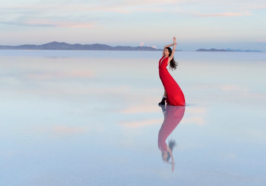
The view of Tunupa reflected in the Salar waters during wet season (November–March) is one of the most powerful visual icons of the Bolivian southwest. The conical volcano perfectly reflected in the salt mirror with 2–5cm water. For the ascent, however, avoid this period — altiplano electrical storms are frequent and dangerous.
May – August
Best time for the summit
May to August months combine the best summit weather (no rain, clear sky, good trail conditions) with the coldest temperatures of the year (down to –25°C at the summit in July–August). If planning the full ascent, bring equipment for extreme cold at the summit. The reward: views of the Salar at your feet under the deepest blue sky of the year.
FAQ

Questions about Tunupa Volcano.

The 5 most common questions about the sacred volcano on the northern shore of Salar de Uyuni.

Plan your trip with us →

Tunupa is a dormant stratovolcano at 5,321m above sea level on the northern shore of the Salar de Uyuni in southwest Bolivia. It is central to the Aymara cosmological legend of the Salar's origin: the goddess Tunupa's tears and breast milk, shed in grief when abandoned by her partner, flowed down the mountain and formed the Salar de Uyuni. The volcano's caves contain pre-Hispanic mummies from the Tiwanaku and Aymara periods. The summit offers the most complete panoramic view of the full Salar de Uyuni (10,582 km²).

Yes, the Tunupa summit (5,321m) is accessible to fit trekkers without technical mountaineering experience in dry season conditions. The ascent from Tahua village (3,650m) takes 4–5 hours and the descent 2.5–3 hours. No ropes or crampons are needed in normal dry-season conditions. However, the altitude gain of 1,671m requires excellent prior acclimatisation — do not attempt if you have been in Bolivia less than 2–3 days or have any altitude sickness symptoms. Hire a local guide from Tahua (Bs 150–200) — the trail is unmarked and the guide knows the mummy cave locations.

Tahua is 120km from Uyuni town by 4×4, approximately 2 hours on the northern route that circles the Salar de Uyuni. There is no public transport — you need a private 4×4 or an organised tour from Uyuni. Most Uyuni operators offer a 2-day Tunupa-Salar circuit (Bs 500–800 per person) that includes transport, guide, and overnight accommodation in Tahua. The road along the northern shore of the Salar passes through the flamingo lagoons — one of the most spectacular drives in Bolivia.

Absolutely. The Tunupa and northern Salar shore experience is valuable independent of the summit. The drive from Uyuni along the northern shore already passes through the flamingo lagoons, offers constant views of the perfectly conical Tunupa against the salt flat, and arrives at the authentic Aymara community of Tahua. The lower slopes have petroglyphs accessible with a 2–3h hike. During mirror effect season (November–March), the reflection of Tunupa in the water-covered Salar is one of the most visually powerful images in Bolivia.

Tahua has basic community-run accommodation (alojamientos) operated by local families. The Alojamiento Tahua is the main option — dormitory and private room style, with shared bathrooms, limited hot water, and basic meals. Rates are approximately Bs 80–150 per person including meals. The experience is authentic but basic — do not expect hotel-standard facilities. Mobile phone signal is limited. Bring cash (no card payment) and a warm sleeping bag as nights reach –5 to –10°C even in summer.

— Plan your Tunupa Volcano expedition

The summit of legend.
5,321 metres.

45 minutes. We design your Tunupa-Salar circuit with 4×4 logistics, Tahua local guide and accommodation.

$90 · €85 · Bs. 623

Book consultation → $90 · €85 · Bs. 623Salar de Uyuni →