Skip to content
Isla Incahuasi Bolivia — cactus Echinopsis atacamensis de 10m y 1200 años de antigüedad en el centro geométrico del Salar de Uyuni
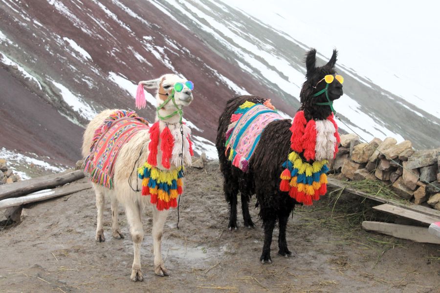
vicuna
— Centre of Salar de Uyuni · 90km from Uyuni · 3,656m · 1,200+ year cacti

Incahuasi Island,
Bolivia.

In the geometric centre of the world's largest salt flat, an island covered in giant cacti over 1,200 years old and 10 metres tall. Fossilised coral beneath your feet proves a prehistoric lake once existed here. The Inca name "house of the Inca" reveals its role as a pre-Hispanic sacred site.

Position
Centre of Salar de Uyuni
Distance
90km from Uyuni
Altitude
3,656m above sea level
Tallest cacti
Up to 10m · 1,200+ years old
Species
Echinopsis atacamensis
Inca name
"Inca Huasi" · house of the Inca
— How long do you need

Always within the Salar tour.

Half day
  • Salar de Uyuni tour (full day or half day)
  • Incahuasi Island: standard tour stop (1.5–2h)
  • Ascent to island viewpoint: 20min walk
  • Descent and return to the Salar

Incahuasi Island is the mandatory stop on all Salar de Uyuni tours. It is automatically included in the standard 4×4 circuit. It is not visited independently — always within the Salar tour.

Salar tour (1 day)
  • 7:00am: Leave Uyuni
  • 7:15am: Train Cemetery (30min)
  • 8:00am: Colchani · salt village
  • 10:00am–12:00pm: Salar interior + perspective photos
  • 12:30pm: Incahuasi Island (lunch + 1.5h exploration)
  • 2:30pm–5:00pm: Return + Salar sunset

The standard 1-day circuit from Uyuni. The Island is the centrepiece of the tour — lunch here (brought by the operator) with Salar views in every direction is one of Bolivia's most unique moments.

Salar tour (3 days)
  • Day 1: Cemetery + south Salar + Incahuasi + sunset
  • Day 2: Coloured lagoons + Andean fauna (Laguna Colorada, Verde)
  • Day 3: Sol de Mañana geysers + San Pedro de Atacama (Chile)

The full circuit. Three days covering the Bolivian southwest into the Atacama Desert in Chile. Incahuasi appears on day one. Specialist operator only. Altitudes up to 5,000m at the southern lagoons.

— What to see at Incahuasi Island

Millennial cacti and reflected sky.

An island in the centre of the world's largest salt flat with 1,200-year cacti, fossilised coral, a 360° viewpoint and the planet's most spectacular mirror effect.

🌵
Entire island · free exploration

Giant Cacti · 1,200+ Years Old

Echinopsis atacamensis · up to 10m tall · one of Bolivia's oldest living things

The Echinopsis atacamensis cacti that cover Incahuasi Island are among the oldest living organisms in Bolivia. The largest specimens are estimated at 1,200–1,500 years old, growing at an average rate of just 1 cm per year — a 10-metre cactus is roughly 1,000 years old. The density of the cacti on the island (thousands of specimens covering every surface) creates a unique visual landscape: an island covered in 10-metre green columns emerging from the flat white salt.

Local tip
The cacti are protected — do not touch or climb them. The spines can cause serious injury. The best photographic compositions place a single large cactus against the white Salar horizon — the island's north side (facing away from the tourist area) tends to be less crowded. Dawn is the best light for cactus photography: the low sun creates long shadows between the columns.
🔭
Island hilltop · 20min ascent

Island Viewpoint · Panoramic Salar

360° panoramic view of the full Salar de Uyuni · mirror effect centre point

The island has a marked trail to a viewpoint at its highest point (approximately 100m above the Salar surface). From this viewpoint, the Salar de Uyuni extends to the horizon in all 360 degrees — there is no other elevated point in the centre of the Salar from which you can see the full extent of the 10,582 km² salt flat. During mirror effect season (November–March), the island appears to float on reflected sky. The viewpoint also gives the clearest perspective on the perfect geometric hexagonal patterns of the salt crystals.

Local tip
The trail to the viewpoint is 20 minutes up and 15 minutes down on a marked rocky path — comfortable in trainers but watch for uneven terrain. The ascent is moderate (no technical difficulty). The crowd peak is 11am–2pm when tour groups converge. Arrive at the island by 9am or after 2pm for fewer people at the viewpoint. The viewpoint is the best place to observe the mirror effect in its most dramatic form during January–February.
🐚
Island rock surfaces

Coral Fossils · Prehistoric Lake Evidence

Coral reef fossils at 3,656m — evidence of Lago Ballivián (prehistoric lake)

The rocky surface of Incahuasi Island contains fossilised marine coral from the prehistoric lake that occupied the Uyuni basin 10,000–40,000 years ago. The Salar de Uyuni is the evaporated residue of Lake Ballivián (later Lake Minchin), which covered an area of approximately 60,000 km² — the salt flat, Lake Titicaca and several other altiplano lakes are all remnants. The coral fossils on Incahuasi are visible as white rounded formations on the rock surface: the same organisms that grew in tropical marine environments millions of years ago later survived in the altiplano lake.

Local tip
The fossilised coral is visible on the lower rocks of the island, particularly on the south-facing slopes. Your guide can point out specific formations — they are easy to overlook without being shown. The coral evidence is scientifically significant: it suggests not only the prehistoric lake but also the tectonic history of the Andes, which pushed formerly coastal terrain to 3,656m altitude.
🏛️
Island history

Inca Sacred Site · "Inca Huasi"

Pre-Hispanic Inca occupation · ceremonial site at the centre of the salt flat

The name "Incahuasi" (or "Inca Huasi") means "house of the Inca" in Quechua — the name itself documents the island's role as an Inca sacred site. The Inca Empire (1438–1533) incorporated the Salar de Uyuni and its salt resources into its administrative and religious network. Incahuasi's position at the exact centre of the Salar likely gave it cosmological significance in Inca worldview. The island also served as a waystation on the Inca road network (Qhapaq Ñan) that crossed the altiplano. Archaeological remains on the island include foundation walls consistent with Inca construction.

Local tip
The island's small museum (located at the entrance area) displays material on the Inca occupation and the geological history of the Salar. Ask your guide to explain the significance of the Inca road network (Qhapaq Ñan) in the altiplano — the Salar de Uyuni was traversable only in dry season and Incahuasi was the only point of orientation in the white immensity. UNESCO inscribed the Qhapaq Ñan as a World Heritage Site in 2014.
🪞
November – March · 2–5cm water depth

Mirror Effect · Best Viewpoint

The Salar mirror effect — seen from the highest point in the centre of the world

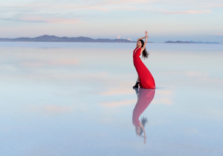
During the wet season (November–March), when 2–5cm of water covers the Salar surface, the mirror effect creates one of the world's most spectacular natural phenomena: the sky and clouds reflect perfectly in the water, and the horizon disappears. Incahuasi Island is the only elevated point from which to observe the mirror effect from the centre of the Salar — the viewpoint on the island gives you a 360° horizon of reflected sky with the giant cacti emerging around you. January and February are the peak months.

Local tip
Mirror effect conditions depend on rainfall: too little water and the hexagonal salt surface shows through; too much water and the surface is too disturbed for a perfect reflection. January–February are statistically the most reliable months. Check conditions with your tour operator the night before — they have daily contact with guides on the Salar. The best mirror effect photos are taken lying flat on the Salar surface with the camera at water level, not from the island viewpoint — the island is for the scale of the vista.
🏺
Island entrance · included in tour

Island Museum · Geology and Inca History

Salar geology, coral fossils, Inca occupation — small but essential

Incahuasi has a small museum at the island entrance building (which also includes a restaurant and toilet facilities). The museum covers three themes: (1) the geology of the Salar de Uyuni and the prehistoric lakes that preceded it; (2) the coral fossils found on the island as evidence of these lakes; (3) the Inca occupation of the island and the Qhapaq Ñan road network across the altiplano. The museum is small but well-curated — allow 15–20 minutes.

Local tip
The museum is included in the tour — no separate ticket. It is the only place on the Salar circuit where you will find detailed geological and historical information in English and Spanish. The restaurant at the island (run by local community) serves lunch and hot drinks — basic but the setting (tables facing the Salar) is extraordinary. Toilet facilities at the island are the only ones available in the Salar interior, so use them before returning.
— Geology and history of Incahuasi Island

The lake that was and the salt flat that remained.

Six contexts to understand the prehistoric geology, Inca history and global significance of the island at the centre of the salt flat.

🌋
Geology: the Salar as a lake residue
The Salar de Uyuni (10,582 km²) is the evaporated residue of Lake Ballivián, a prehistoric lake that covered approximately 60,000 km² of the Bolivian altiplano 40,000 years ago. The lake progressively shrank during the late Pleistocene and Holocene as the altiplano climate became more arid. Lake Titicaca is the largest remnant of this aquatic system. Incahuasi Island is one of the many hills that protruded above the lake surface and now emerges from the salt flat.
🌵
Why the cacti survived on the island
Incahuasi Island is one of the few non-saline surfaces in the centre of the Salar, allowing vegetation to develop. The rocky island soil (volcanic basalt) retains enough moisture for Echinopsis atacamensis growth, which is one of the most drought- and cold-tolerant columnar cactus species in the Andes. The island's isolation also protected the cacti from human depredation for centuries.
⛰️
The Inca Qhapaq Ñan network
The Qhapaq Ñan (Great Inca Road) was the Inca Empire's communication system — over 30,000 km of roads connecting Colombia to Chile. The Bolivian altiplano was a critical route in this system, and the Salar de Uyuni, passable only in dry season, was a segment of it. Incahuasi Island, as the only topographic reference point in the unmeasurable white of the salt flat, had strategic value as a waystation. UNESCO inscribed the Qhapaq Ñan in 2014.
🪨
The hexagonal salt formation
The hexagonal patterns on the Salar de Uyuni's surface are one of its most recognisable features. They form through the expansion and contraction cycles of sodium chloride with temperature changes. In dry season, the surface is a network of crystallised salt hexagons 1–10m in diameter. In wet season, 2–5cm of water cover them creating the mirror effect. From Incahuasi's viewpoint, the hexagonal pattern is clearly visible in the area around the island.
📊
The lithium of Salar de Uyuni
The Salar de Uyuni contains 70% of the world's known lithium reserves — the key mineral in lithium-ion batteries used in electric vehicles and electronic devices. Estimated reserves are 21 million metric tonnes. Bolivia created YLB (Yacimientos de Litio Bolivianos) in 2017 to manage extraction. The lithium industry is one of the region's main geopolitical tensions: Bolivia wants to industrialise the lithium domestically before exporting it, in contrast to the historical raw material export model.
🦩
Salar fauna
The Salar de Uyuni appears barren but harbours adapted fauna. The salt lagoons on its north and south edges are habitat for three Andean flamingo species: the Andean flamingo (Phoenicoparrus andinus, IUCN Vulnerable), James's flamingo (Phoenicoparrus jamesi, IUCN Near Threatened) and the Chilean flamingo (Phoenicopterus chilensis). The wet-season Salar surface attracts migratory ducks and waders. The vicuña (Vicugna vicugna) grazes on the Salar edges.
— From Incahuasi Island and Uyuni

The complete southwest circuit.

Excursion
Full day from Uyuni

Salar de Uyuni · The Full Circuit

Train Cemetery → Colchani → Salar interior → Incahuasi → sunset

Incahuasi Island is the centrepiece of the standard Salar de Uyuni 1-day 4×4 circuit. The full circuit from Uyuni covers: Train Cemetery (7:15am, 30min) → Colchani salt village (8:00am, 30min) → Salar interior perspective photos (10:00am, 2h) → Incahuasi Island (12:30pm, 1.5h including lunch) → Salar sunset (5:00pm) → Uyuni (6:30pm). All operators in Uyuni run this circuit. Prices range from Bs 200 (budget, shared) to Bs 500+ (private, quality vehicle).

Tip
Do not book the cheapest Salar tour. Vehicle reliability in the Salar interior (where distances from rescue are up to 90km) is critical. Read recent reviews, check vehicle condition before departure, and ask if the vehicle has a spare tyre. The quality of the guide and vehicle matters more on the Salar than on any other Bolivia circuit.
Excursion
120km · 2h from Uyuni

Tunupa Volcano · Northern Shore

5,321m summit · Aymara legend · mummies · Tahua village

Tunupa Volcano (5,321m) is on the northern shore of the Salar — the reverse approach to the circuit. Instead of approaching Incahuasi from the south (standard tour), the Tunupa-Salar circuit approaches from the north: Uyuni → flamingo lagoons → Tahua village → Tunupa ascent (optional) → cross Salar south → Incahuasi → Uyuni. The Aymara legend of Tunupa says the goddess's tears created the Salar — making Incahuasi the centre of that sacred geography. The Tunupa circuit (2 days) is the most complete version of the Uyuni experience.

Tip
The 2-day Tunupa-Salar circuit is significantly more expensive than the standard 1-day circuit (Bs 500–800 vs Bs 200–350) but covers much more: the entire Salar from north to south, the flamingo lagoons, Tahua village and the option of the Tunupa summit (4–5h ascent from Tahua). Only operators with experience on the northern route can do this circuit.
Excursion
3km from Uyuni · 5min taxi

Train Cemetery · Uyuni

~30 British steam locomotives · 1890s · free entry · open 24h

The Train Cemetery is the standard first stop of the Salar 4×4 tour (7:15am, 30 minutes). The ~30 British steam locomotives from the 1890s (imported for the Antofagasta-Bolivia Railway) sit 3km from Uyuni town at 3,669m. The site is free and open 24h. For serious photographers, the Train Cemetery deserves a separate pre-dawn visit (5:00–7:00am) for the golden sunrise light — not possible within the standard tour schedule that arrives at 7:15am when the best light has already passed.

Tip
The best Train Cemetery experience requires a separate taxi visit at 5:00am (Bs 15–20 from Uyuni) before your Salar tour. Spend 1.5h in the golden dawn light, return to Uyuni for breakfast, and join the standard Salar tour at 8–9am. The cemetery is on the way from Uyuni to Colchani, so the tour driver will pass it again on the outbound journey.
Excursion
160km from Uyuni · 3h

Potosí · UNESCO Silver City

Cerro Rico · 4,090m · 200 years of silver · Casa de la Moneda · UNESCO

Potosí (4,090m, 160km from Uyuni) is the natural historical complement to the Salar circuit. The silver mined at Cerro Rico funded the Spanish Empire for 200 years (1545–1825) and the FCAB railway (whose locomotives are at the Train Cemetery) was built to transport this ore. Potosí has the Casa de la Moneda (Royal Mint, 1773), spectacular Baroque churches, and guided tours into the active Cerro Rico mines. The city is a UNESCO World Heritage Site. Combine: Uyuni (2 nights) → Potosí (2 nights) → Sucre (1 night).

Tip
The Potosí-Uyuni road is mostly paved — 3h bus journey. Altitude: Potosí at 4,090m is higher than Uyuni (3,669m), so if you've been on the Salar for a day or more, the altitude adjustment is minor. The Cerro Rico mine tour is one of Bolivia's most intense visitor experiences: active mines, dust, dynamite. Not for everyone, but historically essential to understand why the Train Cemetery exists and what the Salar's salt once helped finance.
— How to reach Incahuasi Island

Only by 4×4, only on a tour.

🚙

How to get to Incahuasi Island

  • Incahuasi is 90km from Uyuni — only accessible by 4×4 through the Salar interior
  • No independent transport — visited exclusively within an organised tour
  • Book the Salar tour in Uyuni (Bs 200–350 budget · Bs 500+ private)
  • The tour includes transport, guide, island lunch and all entries
  • Flights to Uyuni (UYU) from La Paz and Cochabamba with BoA
  • There is no way to reach Incahuasi independently in any standard vehicle
ℹ️

On the island: what to know

  • Standard tour visit time: 1.5–2h on the island
  • Viewpoint trail: 20min ascent (moderate, rocky terrain)
  • The cacti are protected — do not touch or climb under any circumstances
  • The island restaurant serves lunch (included in most tours)
  • The only toilet facilities in the Salar interior are on the island
  • Altitude: 3,656m — if it's your first day in Bolivia, take it easy
— Salar climate and seasons

Mirror effect or dry salt?

Jan
Feb
Mar
Apr
May
Jun
Jul
Aug
Sep
Oct
Nov
Dec
January – February
Mirror effect — the great spectacle
The peak wet season (January–February) is when the Salar mirror effect is most intense. With 2–5cm of water covering the surface, the sky reflects perfectly. From Incahuasi's viewpoint, the 360° view of reflected sky with the emerging cacti is Bolivia's most iconic image. You will arrive wetter at the 4×4 in the Salar, but the visual reward is unequalled.
May – August
Dry season — clarity and comfort
The dry season (May–August) offers cloudless skies, bright sun on the white salt and the clearest hexagonal patterns. No mirror effect, but the dry Salar is very photogenic — pure white contrasts with the deep blue of the altiplano sky. Incahuasi Island stands out especially: green cacti on white salt under blue sky is the cleanest contrast.
Year-round
Incahuasi works year-round
Unlike the mirror effect (November–March only), Incahuasi Island is photogenic year-round. The cacti do not change with the seasons — only the surrounding surface (dry salt vs mirror water). If your priority is the mirror effect: January–February. If your priority is the cacti and viewpoint: May–August. If you have fixed dates: any month is valid.
FAQ

Questions about Incahuasi Island.

The 5 most common questions about the island at the centre of the world's largest salt flat.

Plan your trip with us →

Incahuasi Island (Isla Incahuasi or Isla del Pescado) is an island located in the geometric centre of the Salar de Uyuni — the world's largest salt flat (10,582 km²) in southwest Bolivia. The island is covered with Echinopsis atacamensis cacti up to 10 metres tall and estimated at 1,200–1,500 years old. The Inca name "Inca Huasi" (house of the Inca) documents its pre-Hispanic role as a sacred site on the Qhapaq Ñan road network. The island also has fossilised coral from the prehistoric lake that preceded the salt flat.

No. Incahuasi Island is 90km from Uyuni in the interior of the Salar de Uyuni — accessible only by 4×4 vehicle across the salt flat. There is no public transport or independent access. All visits are within organised 4×4 tours booked in Uyuni. The island is the standard centrepiece stop of the 1-day Salar circuit (all operators include it). The tour costs Bs 200–500+ per person depending on operator quality and vehicle type.

The Echinopsis atacamensis cacti on Incahuasi Island are estimated to be between 900 and 1,500 years old. This is calculated from their average growth rate of approximately 1 cm per year — a 10-metre cactus is approximately 1,000 years old. The cacti are protected and cannot be touched or climbed. They are among the oldest living organisms in Bolivia and one of the most impressive natural spectacles in South America.

The Salar de Uyuni mirror effect requires 2–5cm of water on the salt surface. This occurs during the wet season (November–March). January and February are the peak months for the most reliable and intense mirror effect. However, mirror effect conditions depend on actual rainfall that season — a dry wet season may have a weak effect or none at all. Check conditions with your tour operator the day before. The best mirror effect photography (from the Salar surface itself, not the island) requires lying flat with the camera at water level.

Yes, without qualification — Incahuasi Island is one of the most spectacular natural sites in South America and a visit to the Salar de Uyuni without stopping at Incahuasi would be incomplete. The combination of 1,200-year cacti, the 360° Salar panorama from the viewpoint, the fossilised coral, the mirror effect (in season) and the historical Inca context creates an experience with no equivalent on Earth. The island is the centrepiece of every Salar tour for good reason.

— Plan your Salar de Uyuni tour

At the centre of the world.
Surrounded by sky.

45 minutes. We design your Salar tour with the right operator, the correct season and the complete itinerary.

$90 · €85 · Bs. 623

Book consultation → $90 · €85 · Bs. 623Salar de Uyuni →