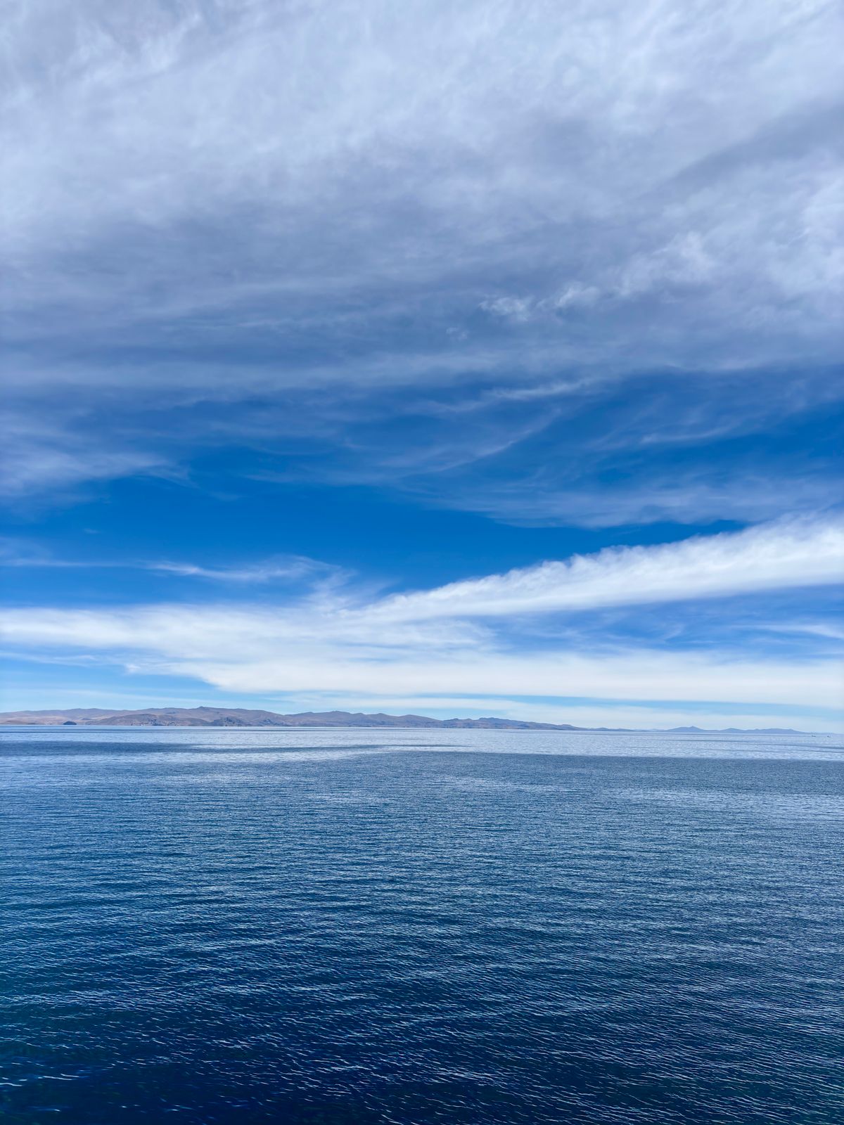
Copacabana is not the famous beach in Rio de Janeiro. Bolivia got there first — the name predates the Brazilian neighbourhood by centuries, borrowed from the Aymara word Qupaqawana meaning “view of the lake.” The Bolivian Copacabana sits at 3,841 metres on a peninsula between two bays of Lake Titicaca, looking out over the world’s highest navigable lake at water that shifts from dark blue to cobalt depending on the hour and the altitude of the clouds.
Most visitors spend four to six hours here before boarding the next bus to La Paz or Puno. That is a mistake.
The Town
Copacabana has about 12,000 residents and one long main street, Avenida 6 de Agosto, that runs from the bus terminal down to the waterfront. The town is small enough to walk entirely in an hour. That hour is not wasted.
The Basilica of Our Lady of Copacabana dominates the main plaza. Construction began in 1601 and was not completed until 1820 — more than two centuries of Moorish-influenced white domed architecture that looks architecturally foreign in the Andean altiplano, which is exactly the point. Inside, behind elaborate silver altarpieces, sits the Dark Virgin of Copacabana: a statue carved from dark maguey wood in 1576 by Francisco Tito Yupanqui, an Inca sculptor from Copacabana who had no formal training and was initially rejected by the Catholic Church for the quality of his work. The statue was accepted after a series of reported miracles. Today it is Bolivia’s patron saint and draws pilgrims from across the country, especially on 2 February (Feast of the Virgin of Copacabana) and during Semana Santa (Holy Week).
On weekends and holidays, the plaza outside the Basilica fills with cars whose owners have come for the bendición de movilidades — a Bolivian tradition in which vehicles are decorated with flowers and streamers and blessed by a priest. This is a genuine and widespread practice, not a tourist display. You will see everything from tuk-tuks to long-haul lorries adorned with tinsel and waiting their turn in the queue.
The waterfront on Avenida Costanera has several decent restaurants serving trucha (Lake Titicaca trout), the local fish. It is not pretentious — plastic chairs, lake views, the occasional fish jumping. Prices are lower than La Paz and the trucha fresher.
Cerro Calvario
The hill directly above the town — Cerro Calvario — is a 45-minute climb via the Stations of the Cross path starting from near the main plaza. The top is occupied by a small shrine and a larger crowd of locals and tourists who gather every afternoon for the sunset.
The view justifies the altitude: Lake Titicaca extending 180 degrees to the horizon, the Isla del Sol visible as a dark shape 15 km offshore, the Cordillera Apolobamba range to the north. At 3,941 m the summit wind is cold — bring a layer regardless of how warm the day feels below.
The path also passes clusters of challa offerings: small handmade clay houses, cars, diplomas, and stacks of banknotes (symbolic, printed for the ritual) that people bring to burn at the summit shrines in petition to Pachamama. This is not a tourist performance — families carry their offerings up the hill in carrier bags, wait their turn at the braziers, and make their petitions quietly. It is worth watching with respectful silence.
Isla del Sol
Every morning at 8:30am (approximate — confirm with the dock), boats depart from the Copacabana waterfront to Isla del Sol, 15 km offshore. The crossing takes about two hours depending on the boat and the wind conditions on the lake.
Isla del Sol (Island of the Sun) covers 14.3 km² and is home to approximately 800 Aymara families in three main communities: Challapampa (north), Challa (centre) and Yumani (south). The island has no cars — everything moves on foot or by donkey. The highest point reaches 4,060 m.
The island contains 80 Inca ruins. The most significant are:
- The Chincana (north end): a labyrinthine palace complex used as a royal rest stop by Inca nobility travelling the lake route. The walls reach 3–4 metres in places and the rooms are more elaborate than most Inca sites in Bolivia.
- The Sacred Rock (north end): a large rock outcropping from which, according to Inca cosmology, the sun god Inti rose at the beginning of time. Sunrise here (around 6:30am in winter, 5:45am in summer) draws visitors who overnight in Challapampa for the ritual.
- The Pilkokaina Temple (south end): a smaller but better-preserved Inca structure with original lintels and niches.
- The Yumani Spring: three stone spouts that emerge at the south village, said by locals to have healing properties. Hikers arriving from the north by the full trail (11 km) reach the spring at the end.
Day trip vs overnight: Most visitors do a day trip, arriving in Isla del Sol around 10:30am and returning to Copacabana by 4pm. This is enough for either the north ruins (Chincana + Sacred Rock) or the south village and spring — not both. The full north-to-south trail (11 km, 3–4 hours) requires arriving at the north by boat and departing from the south by boat — a 2-boat day that most operators do not offer as a day trip. To do it properly, spend one night in Challapampa (north) for the sunrise, walk south through the island, and depart from Yumani (south) back to Copacabana.
Isla de la Luna
Smaller and far quieter than Isla del Sol, Isla de la Luna (Island of the Moon) is visible to the south-east and accessible by boat from Copacabana in about 1.5 hours. It contains the ruins of the Iñak Uyu — an Inca convent (aqllawasi) where the Chosen Women (aqlla) lived in service to the sun cult. The site is less excavated than the Isla del Sol ruins but better preserved in structure. Very few tourists visit.
Boat operators in Copacabana run combined Isla del Sol / Isla de la Luna day trips at approximately Bs 50–70 return per person. The standard route stops at Isla de la Luna for 45 minutes — enough to walk to the ruins and back.
The Bolivia–Peru Crossing
Copacabana sits 8 km from the Kasani border — the main land crossing between Bolivia and Peru. From Kasani you cross on foot to Yunguyo (Peru), then continue by bus to Puno (45 minutes from the border) or by tourist minivan directly to Cusco (6–8 hours from Puno).
Tourist buses that run the La Paz–Copacabana–Puno route operate daily and handle the paperwork logistics at the border. Expect: exit stamp at Bolivian immigration, 200-metre walk across the border, entry stamp at Peruvian immigration, re-boarding the same bus. Total border stop: 30–45 minutes.
Both Bolivia and Peru allow visa-free entry for EU, UK, USA, Canada and Australian passport holders. The crossing is open approximately 8am–9pm daily.
Practical Notes
Getting there from La Paz: Tourist buses depart from the Cementerio district (3.5–4 hours, USD 4–8). The road crosses the Tiquina strait — passengers take a small ferry (Bs 2) while the bus crosses separately on a wooden raft (Bs 20–30 included in the ticket). This crossing takes about 15 minutes and is part of the experience.
Altitude: Copacabana at 3,841 m is slightly higher than La Paz city centre (3,640 m). If you are arriving directly from a low-altitude destination, budget 24 hours of easy activity before hiking Cerro Calvario or planning a full day on Isla del Sol.
Accommodation: Copacabana has a range from backpacker hostels at Bs 50–80/night to comfortable lakeside hotels at USD 60–100. Isla del Sol has basic guesthouses in both Challapampa and Yumani (Bs 80–150/night, meals extra) — bring a warm sleeping bag layer; nights at altitude on the island are cold year-round.
Food: The trout. Order the trucha wherever you eat it. The lake trout is farmed sustainably in Titicaca and is the best local ingredient available — grilled with quinoa or served al vapor (steamed), it bears no resemblance to frozen trout elsewhere.
Key facts
- → Lake Titicaca sits at 3,812 m above sea level and covers 8,372 km² — the world's highest navigable lake and the largest lake in South America by volume.
- → Copacabana town sits at 3,841 m on a peninsula between two bays of Lake Titicaca; population approximately 12,000.
- → The Basilica of Our Lady of Copacabana was constructed between 1601 and 1820 and houses the Dark Virgin of Copacabana — Bolivia's patron saint, carved in 1576 by sculptor Francisco Tito Yupanqui.
- → Isla del Sol (Lake Titicaca) covers 14.3 km² and is home to approximately 800 Aymara families; it contains 80 Inca ruins including the Chincana labyrinth and the Pilkokaina temple.
- → The Bolivia–Peru border crossing at Kasani (Bolivian side) / Yunguyo (Peruvian side) is 8 km from Copacabana and is the most commonly used land border between the two countries.
Frequently asked questions
How do I get from La Paz to Copacabana? +
Tourist buses depart daily from La Paz's Cementerio district (3.5–4 hours, USD 4–8). The route crosses the Tiquina strait by ferry — passengers cross on a small boat while the bus crosses separately on a raft (included in the ticket price). Public minivans from La Paz cost less but take longer. No direct train service exists.
How long should I spend in Copacabana? +
Two nights minimum: one day for the town (Basilica, Cerro Calvario sunset, lakeside dinner) and one full day for Isla del Sol. Three nights allows a proper overnight on Isla del Sol (the only way to see the sunrise ritual at the Sacred Rock and hike the full 11 km north–south trail). Most visitors pass through in 4–6 hours, which is not enough.
Can I cross from Copacabana to Peru? +
Yes. Kasani border (8 km from Copacabana) is the main Bolivia–Peru land crossing. Tourist buses connect Copacabana to Puno, Peru (3.5 hours, USD 8–12) with a border stop at Kasani/Yunguyo. The crossing is straightforward for most nationalities — no visa required for EU, UK, USA, Canada, Australia on either side. Open daily approximately 8am–9pm.