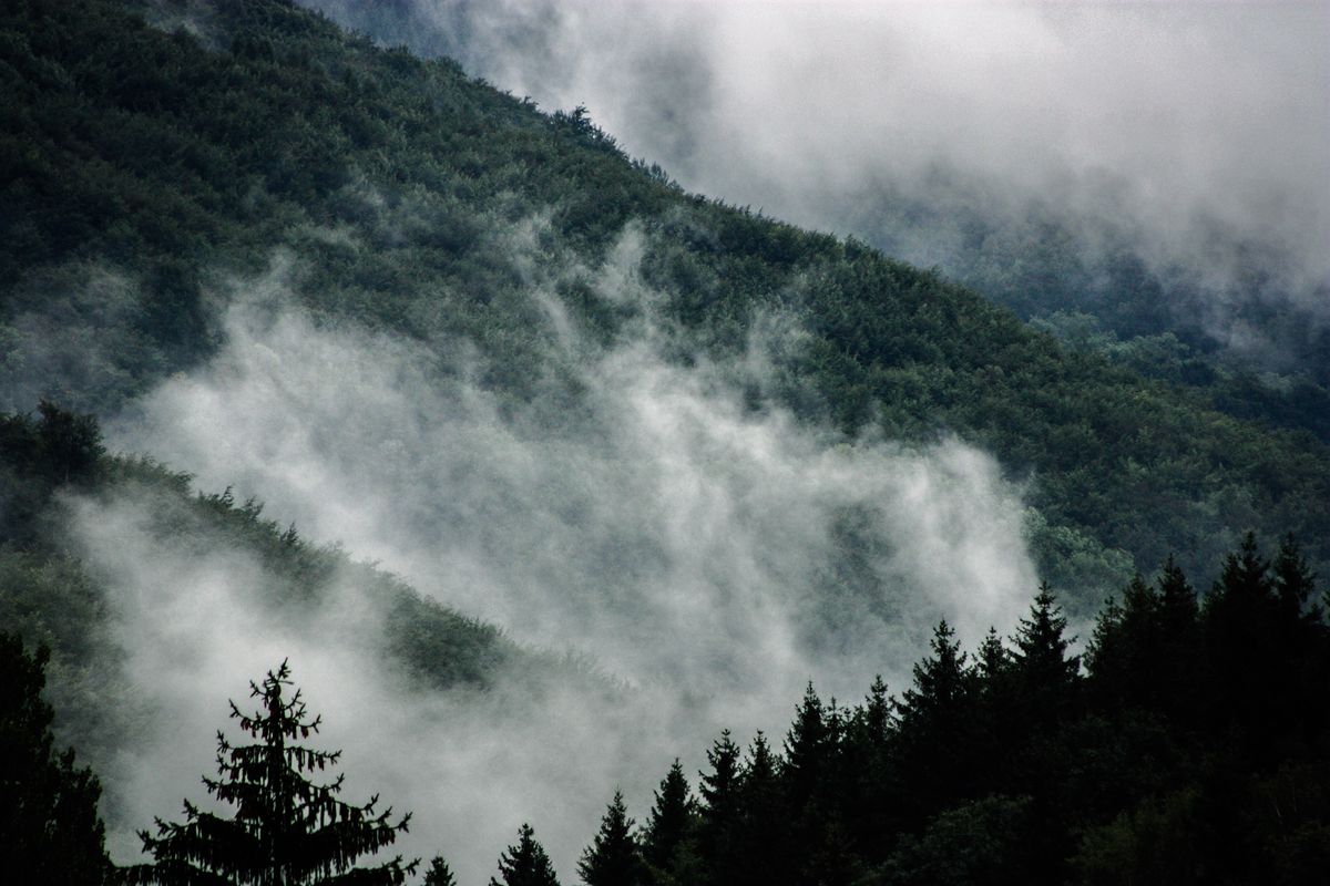
The Bolivian Yungas is the cloud forest that sits between the Andes and the Amazon: a band of steep, permanently misty green valleys on the eastern slope of the Cordillera Real, beginning less than three hours by road from La Paz. It is an ecoregion of 90,500 km² spanning elevations from 400 to 3,500 metres, and the main town travellers use as a base, Coroico, sits at 1,525 m. Most visitors meet the Yungas as a single afternoon on the old Death Road and never realise they have just passed through one of the most biologically dense corners of South America.
It deserves more than an afternoon. Here is what the region actually is, how to get into it, and what it costs.
What the Yungas actually is
“Yungas” is a Quechua and Aymara word for warm valley, and that is the whole idea in one syllable. On a map, Bolivia’s altiplano stops abruptly at the Cordillera Real. On the eastern side of that wall, the land falls away for thousands of metres in a single, uninterrupted slope down towards the Amazon basin. The Yungas is that slope.
What makes it strange is how compressed everything is. In under 100 km of road you go from glaciers and thin, cold air at over 4,600 m to banana trees, tree ferns and humidity you can feel on your skin. The terrain is brutally dissected: narrow V-shaped valleys, near-vertical slopes, and local relief of over 2,000 metres between a ridge and the river below it. There is almost no flat ground anywhere.
That verticality is also what protects it. Steep terrain, constant rain and difficult access have kept much of the ecoregion in a natural state, and today roughly 49.37% of it sits inside ten protected areas, including Amboró, Madidi and Carrasco national parks.
Why “cloud forest” is literal
The montane and upper montane belts of the Yungas are true cloud forest. Mist and cloud cover contribute additional moisture on top of rainfall, so the forest is drinking even on days when it does not rain. The result is a landscape upholstered in epiphytes: bromeliads, orchids, tree ferns and Chusquea bamboo, all growing on top of each other.
The wildlife list reads like a wish list. Spectacled bear, jaguar, lowland tapir, jaguarundi and dwarf brocket deer all live in these forests. Birders come for the Andean cock-of-the-rock, the diademed tapaculo and the southern helmeted curassow. You will not tick most of these off in a weekend, but the birdsong alone tells you where you are.
Coroico: the town most travellers use
Coroico is the political and commercial centre of Nor Yungas province and the practical base for almost everyone visiting the region. It sits on a ridge at 1,525 m with the valley falling away on three sides, which means half the hotels in town have a view most countries would build a national park around.
The municipality counted 12,237 people at the 2001 census, of whom only 2,197 lived in the town itself. It is small, and it feels small. The plaza, a handful of restaurants, a market, and steep cobbled streets that will punish you if you packed a wheeled suitcase.
What you actually do there:
- Waterfalls. The Cascadas de Coroico are the standard half-day walk, reachable on foot or by short taxi ride from town.
- Coffee farms. The Yungas is Bolivian coffee country, and several fincas around Coroico run tastings and tours.
- Walking. Trails to El Calvario, Cerro Uchumachi and the surrounding hamlets start from the plaza. Take water: it is hot in a way La Paz never is.
- Doing nothing. This is the real reason paceños come down. After a week at 3,600 m, sitting in a hammock at 1,500 m with oxygen in the air is a genuine medical intervention.
If you have been struggling in La Paz, the Yungas is the cheapest cure in Bolivia. You are not going soft by dropping 2,000 metres for two nights. Bolivians have been doing exactly this for centuries, and they call it going down to get better.
Chulumani and the southern side
North of the divide you get Coroico and Nor Yungas. South of it you get Chulumani and Sud Yungas, which sees a fraction of the visitors and is, for that reason, the better choice if crowds bother you. The landscape is the same cloud forest, the towns are quieter, the infrastructure is thinner, and the coca terraces climbing the hillsides are more visible than anywhere else in Bolivia.
If it is your first time in the region, go to Coroico. If it is your second, go to Chulumani.
How to get there from La Paz
By bus
This is what most people do and it works fine. Buses to Coroico leave from Villa Fátima in La Paz, roughly hourly, every day. The journey covers about 100 km and takes around 2 hours 40 minutes to 3 hours depending on traffic and weather. Expect to pay from around USD 8 to 10 per person in 2026.
The road is the new highway, paved and fully two-way, which opened in 2006. It is a normal mountain road with normal mountain road switchbacks. Sit on the left going down for the better views.
By shared taxi
Shared taxis also leave from Villa Fátima and cost roughly USD 12 to 18 per seat. They are faster, leave when full rather than on a timetable, and are worth it if you are travelling as a pair or trio. A private taxi for the whole car typically runs USD 50 to 80 one way.
By bike, down the old road
The old Yungas Road is the famous one. Since the new highway opened in 2006 it carries almost no vehicle traffic and is used mainly by cyclists, who descend roughly 3,500 vertical metres from La Cumbre pass down into the Yungas. Organised tours typically cost USD 70 to 130 including bike, guide, gear and transport back. If you are considering it, read our Death Road biking guide first, and be selective about the operator.
Most bike tours finish in or near Coroico, which means you can simply stay the night instead of being driven back up to La Paz the same evening. Do that. It is the best decision available to you.
Best time to visit
Bolivia’s dry season, roughly May to September, is the safest window. Roads are stable, landslides are rarer, and you get the clearest long views across the valleys. Nights in Coroico are mild rather than cold.
The wet season, December to March, brings heavy rain, frequent landslides and occasional road closures. It is also when the Yungas looks most like itself: saturated green, waterfalls at full volume, cloud pouring over the ridgelines all afternoon. If you are flexible and not on a tight schedule, it is spectacular. If you have a flight to catch, it is a risk.
April and October are the sensible compromise months.
Coca, coffee and what grows here
You cannot travel through the Yungas without noticing the coca. The terraces are everywhere, cut into slopes that look impossible to farm. The Yungas around Coroico is a traditional coca-growing area and the smallest of Bolivia’s three coca-producing regions. This is legal, traditional cultivation, and coca leaf here is chewed and brewed exactly as it has been for centuries. Do not photograph farms or workers without asking.
Alongside coca the region produces coffee, citrus, bananas and timber, and supplies a large share of La Paz’s fruit. If you eat a mandarin in the La Paz market in July, there is a good chance it came up this same road.
Cotapata and the Choro trek
Cotapata National Park and Integrated Management Natural Area protects 600 km² of Yungas terrain about 50 km from La Paz, spread across the Nor Yungas and Murillo provinces. It was created on 9 July 1993, and the national park proper covers around 40% of the total area, with the rest managed for integrated use.
Cotapata is also where the Choro trek ends. The Choro is the classic three-day hike from the Cordillera Real down into the cloud forest, following a pre-Hispanic paved route and descending several thousand metres from puna grassland into dense green. It is one of the best treks in Bolivia and, because it is a descent, more achievable than its length suggests, though the constant downhill is hard on knees.
Practical tips from a Bolivian
- Bring a real rain jacket. Not a windbreaker. It rains in the Yungas in every month of the year, just less often in winter.
- Cash only, mostly. There are ATMs in Coroico but they run dry and card acceptance is patchy. Bring bolivianos from La Paz.
- Expect insects. Mosquitoes and, in the wet season, sandflies. Repellent is not optional.
- Book ahead for holidays. Coroico fills completely during Carnival, Easter and Bolivian long weekends because half of La Paz has the same idea.
- Leave the good luggage. Steep cobbles, unpaved lanes and stairs everywhere. A backpack beats a suitcase every time.
- Do not rush the road. If it has been raining hard, take the bus rather than a fast shared taxi, and accept that a landslide delay is part of the deal.
Before you go
The Yungas is the easiest wild place to reach in Bolivia. It is three hours from the country’s biggest airport hub, it costs under ten dollars to get to, and it drops you into a genuinely different climate, ecosystem and pace of life. The mistake almost everyone makes is treating it as a stop on the way somewhere else.
Give it two nights. Come back up when the altiplano stops feeling like an obstacle.
Key facts
- → The Bolivian Yungas ecoregion covers 90,500 km² and spans elevations from 400 to 3,500 metres on the eastern slopes of the Andes.
- → Coroico, the main town of Nor Yungas province, sits at 1,525 m (5,003 ft), roughly 2,100 m lower than La Paz.
- → About 49.37% of the Yungas ecoregion is protected across ten areas, including Amboró, Madidi and Carrasco national parks.
- → Cotapata National Park protects 600 km² of Yungas cloud forest. It was created on 9 July 1993 and lies about 50 km from La Paz, split between the Nor Yungas and Murillo provinces.
- → Buses from La Paz to Coroico leave hourly, cover roughly 100 km, take about 2h40m to 3h and cost from around USD 8 to 10 in 2026.
- → The Coroico municipality recorded 12,237 inhabitants at the 2001 census: 2,197 urban and 10,040 rural.
- → The Yungas around Coroico is the smallest of Bolivia's three traditional coca-growing regions, alongside coffee, citrus and timber production.
- → A new paved La Paz to Coroico highway opened in 2006. The old Yungas Road, known as the Death Road, is now used mainly by cyclists.
Frequently asked questions
Do I need to worry about altitude sickness in the Yungas? +
The opposite, in fact. Coroico sits at 1,525 m, about 2,100 m below La Paz, so most people feel noticeably better within an hour of arriving. That is exactly why paceños go down there to recover. The one thing to watch is the descent itself: dropping 2,000 m in under three hours can give you a headache or blocked ears, so drink water and go easy on your first evening.
Is the Yungas the same thing as the Death Road? +
No. The Death Road, properly the old Yungas Road, is one road that crosses the region. The Yungas is a whole ecoregion of 90,500 km² of cloud forest running down the eastern Andes. The bike descent is the most famous way to enter, but you can reach Coroico on the paved highway that opened in 2006 without ever touching the old road.
When is the best time to visit the Yungas? +
May to September, Bolivia's dry season, gives you the clearest views and the most reliable roads. The trade-off is that the cloud forest is least dramatic when it is dry. December to March brings heavy rain, landslides and road closures, but also the greenest forest and the fullest waterfalls. If you want a compromise, aim for April or October.
How many days should I spend in the Yungas? +
Two nights is the honest minimum. A single overnight means you spend most of your time on the road. With two nights in Coroico you can do one full day of waterfalls, coffee farms or walking, and still have a slow morning before heading back up. Trekkers doing the Choro trail from the Cordillera Real down into Cotapata should budget three days.