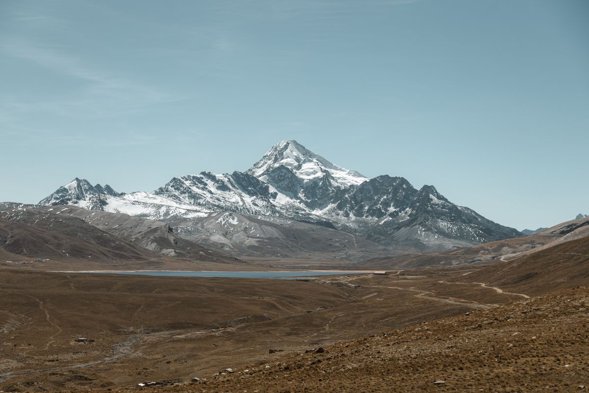
Huayna Potosí is the reason a surprising number of travellers who have never worn crampons in their lives go home from Bolivia saying they climbed a 6,000-metre mountain. The summit stands at 6,088 m (19,974 ft), roughly 25 km north of La Paz in the Cordillera Real, and the normal route is a walk-up on glacier that a fit, properly acclimatised beginner can complete with a guide in two or three days. You can be drinking coffee in La Paz on Monday morning and standing on the summit ridge on Wednesday at sunrise.
That accessibility is real, but it comes with an asterisk that agencies rarely print on the flyer. Below is what the climb actually involves, what it costs in 2026, and the one thing that decides whether you reach the top.
Why Huayna Potosí gets called the “easiest 6,000er”
Three things line up here in a way they do almost nowhere else on earth.
The first is the road. A dirt track climbs from El Alto over the Zongo Pass at 4,700 m and drops you within walking distance of base camp. You start the climb almost a vertical kilometre above where most mountains of this size begin.
The second is the route itself. The line first climbed in 1919 by Rudolph Dienst and Adolf Schulze on a German-Austrian expedition — up the east face — is still the standard ascent, and it is technically modest: a long glacier slope, a few crevasse crossings, and a final 40–50° pitch below the summit ridge.
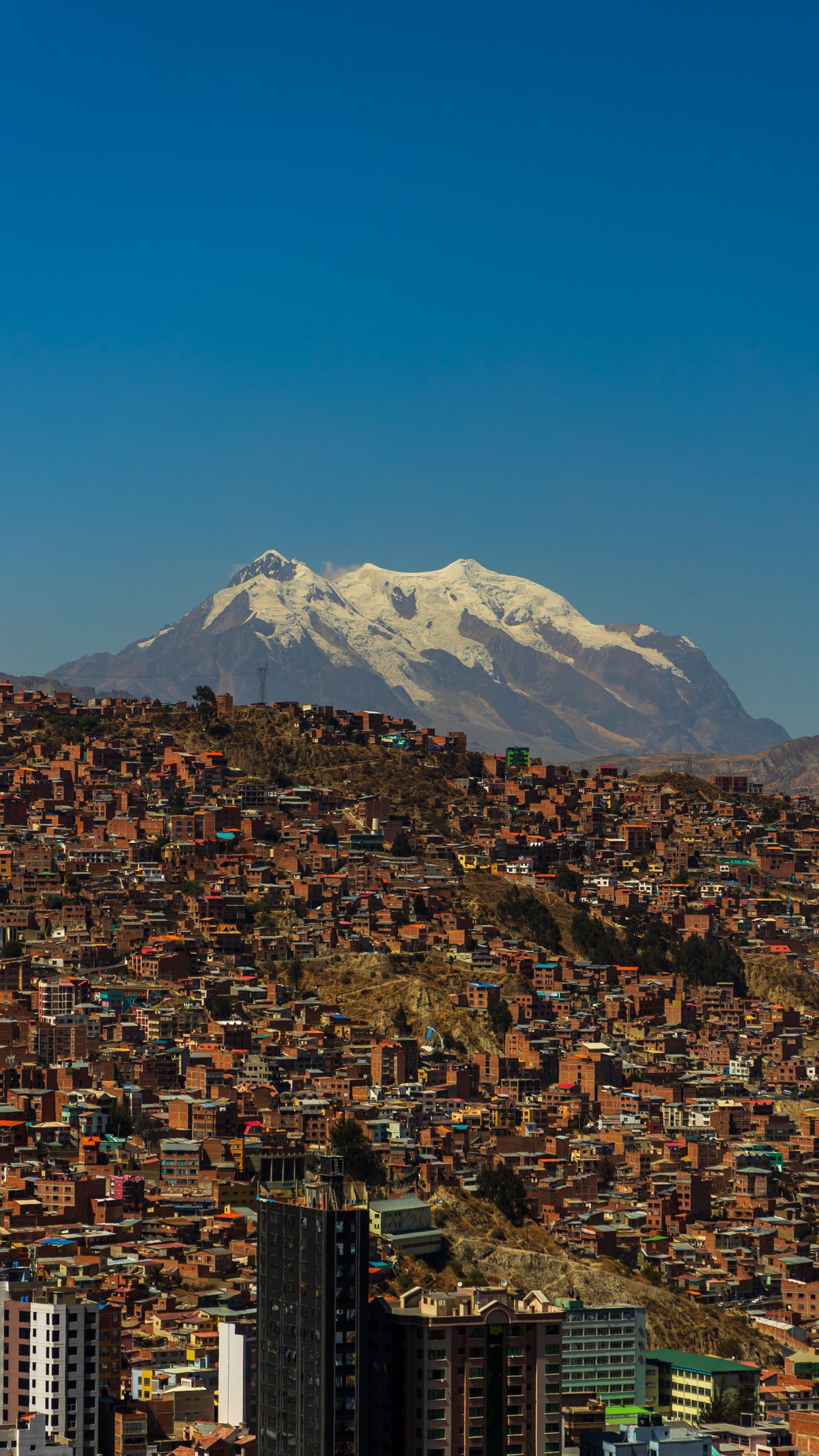
The third is the city. La Paz sits at 3,640 m and El Alto at 4,150 m. Spending a week eating salteñas and riding the teleférico is, whether you notice it or not, altitude training.
The asterisk
“Easiest” is a comparison with other 6,000-metre peaks, not with hiking. The final slope is genuinely steep and exposed, you will be roped to a guide on a glacier with real crevasses, and summit day starts somewhere around 1 a.m. in temperatures that regularly sit between −10°C and −20°C with wind. People turn around on Huayna Potosí every single week. Almost none of them turn around because of the climbing.
The route, day by day
Day 1 — Zongo Pass and glacier school
Transport leaves La Paz mid-morning and takes about 1.5–2 hours to reach the Zongo Pass. On the three-day itinerary you spend the afternoon on a small practice glacier below base camp learning the essentials: walking flat-footed in crampons, front-pointing, ice-axe self-arrest, and moving as a roped team. Some agencies add a short ice-climbing session on a serac, which is more fun than it is necessary.
Night one is spent in a refuge at around 4,700–4,800 m. They are basic — bunk rooms, a wood stove, shared bathrooms — and cold enough that you sleep in most of your layers.
Day 2 — the walk up to high camp
This is a short day and deliberately so. The hike from base camp to Campo Alto at 5,200 m takes two to three hours over rocky moraine with a heavy pack. You arrive by early afternoon, eat an early dinner around 5 p.m., and try to sleep by 7.
Nobody sleeps well at 5,200 m. Expect to lie awake, breathing oddly, listening to the wind. This is normal and does not mean your summit is doomed.
Day 3 — summit day
The guide wakes you between midnight and 1 a.m. You climb by headtorch, roped in groups of two or three per guide, across a long snow bench and then up steepening slopes. The crux is a short, steep section beneath the summit ridge — nothing technical, but genuinely airy. Total climbing time to the top is 5–7 hours over roughly 900 vertical metres.
Sunrise usually catches you on the upper slopes, and this is the part nobody warns you about properly: Illimani, Lake Titicaca and the entire Altiplano appear at once, and the shadow of the mountain lies across the plain behind you. Descent back to high camp takes 2–3 hours, and you are usually back in La Paz by late afternoon.
Two days or three days?
| 2-day | 3-day | |
|---|---|---|
| Glacier school | Minimal or none | Half day included |
| Nights on the mountain | 1 (high camp) | 2 (base + high camp) |
| Best for | Acclimatised climbers with crampon experience | Everyone else |
| Typical price | USD 150–250 | USD 200–320 |
If you have been in Bolivia less than a week, take the three-day option. The extra night is not comfort — it is acclimatisation, and it is the single cheapest improvement you can make to your odds.
How to get there from La Paz
You do not organise this independently. Every climb runs through a La Paz agency, and transport is included in the package. Practically speaking:
- Agencies cluster on Calle Sagárnaga and Illampu in the old centre. Walking in and comparing three of them takes an hour and saves real money over booking online.
- Departure is from central La Paz, via El Alto and the Zongo road. Allow 1.5–2 hours each way.
- Ask directly whether your guide is certified by the Asociación de Guías de Montaña de Bolivia, and what the guide-to-client ratio is. Insist on 1:2 maximum. A guide roped to three tired clients cannot help any of them properly.
What it costs in 2026
Booked in person in La Paz, expect USD 150–250 for the 2-day climb and USD 200–320 for the 3-day. That price normally includes:
- Certified guide and transport from La Paz
- Refuge accommodation at base camp and high camp
- All meals on the mountain
- Full rental kit — double boots, crampons, ice axe, harness, helmet, gaiters and an insulated jacket
Budget separately for around Bs 50 in local community access fees, tips for the guide (Bs 100–200 is normal and appreciated), and a decent pair of your own gloves and sunglasses. Booking through an international platform typically doubles the price for the same guides.
When to climb
The dry season, May to September, is the climbing season, and there is little debate about it. Skies are clear, the glacier is stable, and the standard route is in condition.
- May–June: coldest nights but the most reliable weather and the firmest snow.
- July–August: peak season. Best conditions, most people on the route, book a few days ahead.
- September: still good, warmer, slightly less predictable.
- November–March: the wet season. Snowfall, poor visibility and higher avalanche risk. Most reputable agencies will not run the climb.
Acclimatisation is the whole game
Say it plainly: almost everyone who fails on Huayna Potosí fails because of altitude, not difficulty. A workable plan looks like this.
- Days 1–3: arrive in La Paz, walk slowly, drink water, skip alcohol. Do nothing ambitious.
- Days 4–5: a high day hike — Chacaltaya (5,395 m) or the Condoriri valley — then sleep back in the city.
- Days 6–7: rest, eat well, check your rental gear fits properly.
- Day 8 onward: start the climb.
Coca tea helps mildly with headaches. Acetazolamide, if your doctor approves it in advance, helps considerably more. Neither substitutes for time. If you are unsure how your body handles altitude at all, read our altitude guide before you commit to anything above 5,000 m.
The mountain is not the hard part. Arriving in Bolivia on a Thursday and trying to stand at 6,088 m on a Sunday is the hard part — and that is a decision you make in a booking window, weeks before you ever see the glacier.
The glacier is disappearing, and that matters
This is not an abstraction here. The western Huayna Potosí glacier is retreating upslope at approximately 24 metres per year, and researchers monitoring Bolivia’s tropical glaciers expect it could vanish within a couple of decades if current trends hold. The nearby Chacaltaya glacier — once home to the world’s highest ski run — lost 89% of its surface area from its Little Ice Age maximum and finally disappeared in 2007.
Around one million people in El Alto depend on meltwater from this range for drinking water, and communities in the valleys below rely on it for irrigation and grazing. When Bolivian guides talk about the route being “different from ten years ago”, they are describing something their own families measure at the tap.
Climbing here responsibly means carrying every scrap of rubbish out, using the community’s designated camps, and hiring local certified guides rather than the cheapest operator you can find.
Practical tips from people who live here
- Bring your own gloves, sunglasses and sunscreen. Rental gloves are the weakest link in every agency’s kit, and glacial UV at 6,000 m is punishing.
- Try the boots on before you leave La Paz. Double boots that pinch at sea level are unbearable at 5,200 m. Do not accept “they’ll be fine”.
- Eat on summit day even if you don’t want to. Appetite disappears at altitude; energy does not come back on its own.
- Carry Bs in small notes. Community fees, tips and the refuge shop are all cash.
- Set your expectations honestly. Turning around at 5,800 m because you are hypothermic is a good decision, not a failed trip. Guides respect it, and so should you.
Before you book
Huayna Potosí works because Bolivia stacked a road, a glacier and a high-altitude city almost on top of each other. That does not make the mountain trivial — it makes it available, which is a very different word. Give yourself the acclimatisation days, pay for the certified guide, take the three-day option, and there is a genuinely good chance you will watch the sun come up over the Cordillera Real from 6,088 metres.
If you would rather see the range without the crampons, the Cordillera Real trekking routes — the Choro, Taquesi and Condoriri circuits — deliver the same mountains at a friendlier angle.
Key facts
- → Huayna Potosí reaches 6,088 m (19,974 ft) and lies approximately 25 km north of La Paz, in the Cordillera Real of Bolivia's La Paz department.
- → The first ascent was made in 1919 by Rudolph Dienst and Adolf Schulze on a German-Austrian expedition, via the east face — the line that is still the normal route today.
- → The standard climb begins at Zongo Pass (4,700 m) and uses a high camp at 5,200 m; summit day covers roughly 900 vertical metres and takes 5–7 hours of climbing on glacier.
- → Zongo Glacier is the largest glacier on the mountain at 2.4 km².
- → The western Huayna Potosí glacier is retreating upslope at approximately 24 metres per year, and about one million residents of El Alto depend on glacial meltwater from the range.
- → The Cordillera Real stretches 125 km in length and 20 km in width, with Illimani (6,438 m) as its highest summit.
Frequently asked questions
Do you need mountaineering experience to climb Huayna Potosí? +
No prior experience is required for the normal route, and this is exactly why the mountain is famous. Agencies include a half-day glacier school where you learn to walk in crampons, self-arrest with an ice axe and move roped up. What you do need is genuine fitness and proper acclimatisation. The rock and ice are straightforward; the altitude is not.
How long should I acclimatise in La Paz before climbing? +
Plan a minimum of five to seven days above 3,500 m before you set foot on the mountain. La Paz sits at 3,640 m and El Alto at 4,150 m, so simply being in the city counts. Most climbers who fail on Huayna Potosí fail because they arrived four days earlier, not because the route defeated them. Day hikes to Chacaltaya or Condoriri are the standard preparation.
Should I book the 2-day or the 3-day Huayna Potosí tour? +
Take the 3-day version unless you are already well acclimatised and comfortable with crampons. The extra day is spent at base camp on glacier-skills training and a short acclimatisation walk, which measurably improves summit chances. The 2-day option compresses everything: you drive up, hike to high camp and leave for the summit around 1 a.m. the same night.
How much does it cost to climb Huayna Potosí? +
Expect roughly USD 150–250 for a 2-day guided climb and USD 200–320 for the 3-day version, booked in person in La Paz. That normally covers a certified guide, transport from La Paz, meals, refuge accommodation and the full rental kit: double boots, crampons, ice axe, harness, helmet and jacket. Budget an extra Bs 50 or so for the local community access fee.